 |
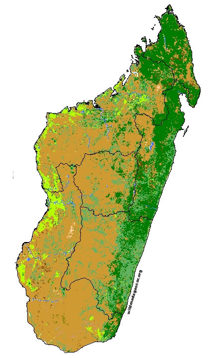
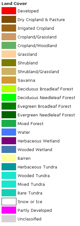
Map showing land cover / vegetation types in MadagascarThis map has been adapted from the FAO Country Profiles and Mapping Information System (The United Nations Food and Agricultural Organization) materials. All data is copyright � FAO 2004.
Madagascar MAPS Index. The above image has been adapted from a NASA satellite photo. To learn more visit The Earth Observatory |
|
home | photos index | search | about | contact Unless otherwise noted, all content and images are the property of Rhett Butler, content copyright 2004-2006. All rights reserved. |

